Search This Blog


Showing posts with label Places. Show all posts

Thursday, July 14, 2011

The Least Populated Countries in The World

The Least Populated Countries in The World

10 - Dominica 72,500


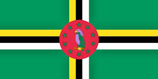
Dominica, (French: Dominique) officially the Commonwealth of Dominica, is an island nation in the Caribbean Sea. To the north-northwest lies Guadeloupe, to the southeast Martinique. Its size is 754 square kilometres (291 sq mi) and the highest point in the country is Morne Diablotins, which has an elevation of 1,447 metres (4,750 ft). The Commonwealth of Dominica has an estimated population of 72,500. The capital is Roseau.


Dominica has been nicknamed the "Nature Isle of the Caribbean" for its seemingly unspoiled natural beauty. It is the youngest island in the Lesser Antilles, still being formed by geothermal-volcanic activity, as evidenced by the world's second-largest boiling lake. The island features lush mountainous rainforests, home of many rare plant, animal and bird species. There are xeric areas in some of the western coastal regions, but heavy rainfall can be expected inland. The Sisserou Parrot (also known as the Imperial Amazon), the island's national bird, is featured on the national flag. Dominica's economy is heavily dependent on both tourism and agriculture. More images after the break...
Christopher Columbus named the island after the day of the week on which he spotted it, a Sunday (dominica in Latin), November 3, 1493. In the next hundred years after Columbus' landing, Dominica remained isolated, and even more Caribs settled there after being driven from surrounding islands as European powers entered the region. France formally ceded possession of Dominica to the United Kingdom in 1763. The United Kingdom then set up a government and made the island a colony in 1805.

The emancipation of African slaves occurred throughout the British Empire in 1834, and, in 1838, Dominica became the first British Caribbean colony to have a legislature controlled by an African majority. In 1896, the United Kingdom reassumed governmental control of Dominica, turning it into a Crown colony. Half a century later, from 1958 to 1962, Dominica became a province of the short-lived West Indies Federation. In 1978, Dominica became an independent nation. Link


09 The Marshall Islands 62,000


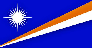
The Marshall Islands en-us-Marshall Islands.ogg, officially the Republic of the Marshall Islands (RMI), is a Micronesian nation of atolls and islands in the middle of the Pacific Ocean, just west of the International Date Line and just north of the Equator. This nation of roughly 62,000 people is located north of Nauru and Kiribati, east of the Federated States of Micronesia, and south of the U.S. territory of Wake Island, to which it lays claim. Link


08 Saint Kitts and Nevis 52,000


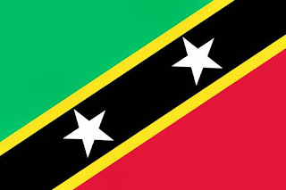
The Federation of Saint Kitts and Nevis (also known as the Federation of Saint Christopher and Nevis),[2] located in the Leeward Islands, is a federal two-island nation in the West Indies. It is the smallest sovereign nation in the Americas, in both area and population.


The capital city and headquarters of government for the federated state is Basseterre on the larger island of Saint Kitts. The smaller state of Nevis lies about 2 miles (3 km) southeast of Saint Kitts, across a shallow channel called "The Narrows".

Historically, the British dependency of Anguilla was also a part of this union, which was then known collectively as Saint Christopher-Nevis-Anguilla. Saint Kitts and Nevis are geographically part of the Leeward Islands. To the north-northwest lie the islands of Saint Eustatius, Saba, Saint Barthélemy, and Saint-Martin/Sint Maarten. To the east and northeast are Antigua and Barbuda, and to the southeast is the small uninhabited island of Redonda, and the island of Montserrat, which currently has an active volcano (see Soufrière Hills).

Saint Kitts and Nevis were amongst the first islands in the Caribbean to be settled by Europeans. Saint Kitts was home to the first British and French colonies in the Caribbean. Link


07 Liechtenstein 35,000


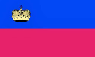
The Principality of Liechtenstein German: Fürstentum Liechtenstein, correct-German-pronunciation-of-Fuerstentum-Liechtenstein.ogg is a doubly landlocked alpine microstate in Western Europe, bordered by Switzerland to the west and south and by Austria to the east. Its area is just over 160 km² (about 61.7 square miles) and it has an estimated population of 35,000. Its capital is Vaduz; the biggest town is Schaan.


Liechtenstein is the smallest German-speaking country in the world, and the only alpine country to lie entirely within the Alps. It is also the only German-speaking country not to share a common frontier with Germany. It is a constitutional monarchy divided into 11 municipalities. Much of Liechtenstein's terrain is mountainous, making it a winter sports destination. Many cultivated fields and small farms characterize its landscape both in the north (Unterland, lower land) and in the south (Oberland, upper land). The country has a strong financial sector located in the capital, Vaduz, and has been identified as a tax haven. It is a member of the European Free Trade Association but not of the European Union. Liechtenstein is the richest country in the world on a per-capita basis. Link


06 - Monaco - 33,000


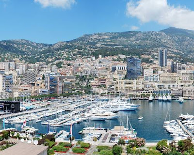
Monaco en-us-Monaco.ogg, officially the Principality of Monaco (French: Principauté de Monaco; Monégasque: Principatu de Múnegu; Italian: Principato di Monaco; Occitan: Principat de Mónegue), is a small sovereign city-state located in South Western Europe on the northern central coast of the Mediterranean Sea. It is surrounded on three sides by its neighbour, France, and its center is about 16 km (9.9 mi) from Italy. Its area is just under 2 km² with an estimated population of almost 33,000.

Monaco is the name of the country and its capital (and only) city. It is famous as a tax haven, and wealthy foreigners make up the majority of the population, around 84%. Monaco is a constitutional monarchy and principality, with Prince Albert II as head of state. The House of Grimaldi has ruled Monaco since 1297, and the state's sovereignty was officially recognized by the Franco-Monegasque Treaty of 1861. Despite being independent, Monaco's defence is the responsibility of France. Link


5 - San Marino - 30,000


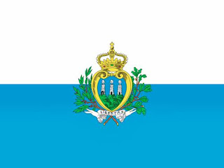
The Most Serene Republic of San Marino Italian: Serenissima Repubblica di San Marino) is a country situated in the Apennine Mountains. It is a landlocked enclave, completely surrounded by Italy. Its size is just over 60 km2 with an estimated population of almost 30,000. Its capital is the City of San Marino. One of the European microstates along with Liechtenstein, the Vatican, Monaco, Andorra, and Malta, San Marino has the smallest population of all the members of the Council of Europe.


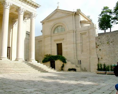
San Marino is the oldest recorded sovereign state and constitutional republic in the world, having been founded on 3 September 301 by stonecutter Marinus of Rab. Legend has it that Marinus left Rab, then a Roman colony, in 257 when the future emperor, Diocletian, issued a decree calling for the reconstruction of the city walls of Rimini, which had been destroyed by Liburnian pirates. The constitution of San Marino, enacted in 1600, is the world's oldest constitution still in effect. Link


4 - Palau - 20,000


Palau en-us-Palau.ogg, officially the Republic of Palau (Palauan: Beluu er a Belau), is an island nation in the Pacific Ocean, some 500 miles (800 km) east of the Philippines and 2,000 miles (3,200 km) south of Tokyo. Having emerged from United Nations trusteeship (administered by the United States) in 1994, it is one of the world's youngest and smallest sovereign states. In English, the name is sometimes spelled Belau in accordance with the native pronunciation. It was formerly also spelled Pelew. Link


3 - Tuvalu - 12373


Tuvalu , formerly known as the Ellice Islands, is a Polynesian island nation located in the Pacific Ocean, midway between Hawaii and Australia. Its nearest neighbours are Kiribati, Samoa and Fiji. It comprises four reef islands and five true atolls. Its population of 12,373 makes it the third-least-populated sovereign state in the world, with only Vatican City and Nauru having fewer inhabitants. In terms of physical land size, at just 26 square kilometres (10 sq mi) Tuvalu is the fourth smallest country in the world, larger only than the Vatican City at 0.44 km2 (0.17 sq mi), Monaco at 1.95 km2 (0.75 sq mi) and Nauru at 21 km2 (8.1 sq mi).


The first inhabitants of Tuvalu were Polynesian people. The islands came under the UK's sphere of influence in the late 19th century. The Ellice Islands were administered by Britain as part of a protectorate from 1892 to 1916 and as part of the Gilbert and Ellice Islands Colony from 1916 to 1974. In 1974, the Ellice Islanders voted for separate British dependency status as Tuvalu, separating from the Gilbert Islands which became Kiribati upon independence. Tuvalu became fully independent within the Commonwealth in 1978. Link
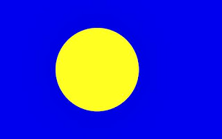
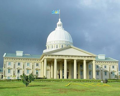

02 - Nauru - 10,000


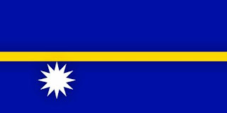
Nauru (pronounced, officially the Republic of Nauru and formerly known as Pleasant Island, is an island nation in Micronesia in the South Pacific. Its nearest neighbor is Banaba Island in Kiribati, 300 km to the east. Nauru is the world's smallest island nation, covering just 21 square kilometres (8.1 square miles).


Settled by Micronesian and Polynesian people, Nauru was annexed and claimed as a colony by the German Empire in the late 19th century. After World War I, Nauru became a League of Nations mandate administered by Australia, New Zealand, and the United Kingdom. During World War II, Nauru was occupied by Japanese troops who were bypassed by the Allied advance across the Pacific, and after the war ended, it entered into trusteeship again. Nauru was declared independent in 1968.

Throughout the first half of the 20th century, Nauru was a "rentier state". Nauru is a phosphate rock island, with deposits close to the surface, which allow for simple strip mining operations. This island was a major exporter of phosphate starting in 1907, when the Pacific Phosphate Company began mining there, through the formation of the British Phosphate Commission in 1919, and continuing after independence. This gave Nauru back full control of its minerals under the Nauru Phosphate Corporation, until the deposits ran out during the 1980s. For this reason, Nauru briefly boasted the highest per-capita income enjoyed by any sovereign state in the world during the late 1960s and early 1970s. When the phosphate reserves were exhausted, and the environment had been seriously harmed by mining, the trust established to manage the island's wealth became greatly reduced in value. To earn income, the government resorted to unusual measures. In the 1990s, Nauru briefly became a tax haven and illegal money laundering center. From 2001 to 2008, it accepted aid from the Australian government in exchange for housing an illegal migrant detention center that held and processed asylum seekers trying to enter Australia.
From December 2005 to September 2006, Nauru became partially isolated from the outside world when Air Nauru, the only airline with service to the island, ceased to operate. The only outside access to Nauru was then by ocean-going ships. The airline was able to restart operations under the name Our Airline with monetary aid from Taiwan.
On 15 December 2009 Nauru became the fourth country to recognise Abkhazia, and on 16 December recognised South Ossetia, regions of Georgia which had been de facto independent since the early 1990s and were recognised as such by Russia after the brief Russia-Georgia summer war of 2008. Reports suggest that this decision netted Nauru Russian aid of around US$50,000,000. Link


01 The Vatican City - 800


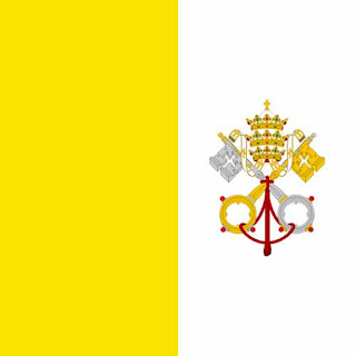
Vatican City en-us-Vatican City.ogg, officially the State of the Vatican City (Italian: Stato della Città del Vaticano, pronounced, is a landlocked sovereign city-state whose territory consists of a walled enclave within the city of Rome, the capital city of Italy. It has an area of approximately 44 hectares (110 acres) (0.44 km2), and a population of just over 800.

Vatican City is a city-state that came into existence in 1929. It is distinct from the Holy See, which dates back to early Christianity and is the main episcopal see of 1.147 billion Latin and Eastern Catholic adherents around the globe. Ordinances of Vatican City are published in Italian; official documents of the Holy See are issued mainly in Latin. The two entities even have distinct passports: the Holy See, not being a country, only issues diplomatic and service passports; the state of Vatican City issues normal passports. In both cases the passports issued are very few.

The Lateran Treaty in 1929, which brought the city-state into existence, spoke of it as a new creation (Preamble and Article III), not as a vestige of the much larger Papal States (756-1870) that had previously encompassed central Italy. Most of this territory was absorbed into the Kingdom of Italy in 1860, and the final portion, namely the city of Rome with a small area close to it, ten years later, in 1870.

Vatican City is an ecclesiastical or sacerdotal-monarchical state, ruled by the bishop of Rome—the Pope. The highest state functionaries are all Catholic clergymen of various nationalities. It is the sovereign territory of the Holy See (Sancta Sedes) and the location of the Pope's residence, referred to as the Apostolic Palace.

The Popes have resided in the area that in 1929 became Vatican City since the return from Avignon in 1377. Previously, they resided in the Lateran Palace on the Caelian Hill on the opposite side of Rome, which site Constantine gave to Pope Miltiades in 313. The signing of the agreements that established the new state took place in the latter building, giving rise to the name of Lateran Pacts, by which they are known.

Seven Wonders Of India

Seven Wonders Of India

1. Taj Mahal
Taj Mahal, built in the memory of the queen Mumtaz Mahal

Taj Mahal (also "the Taj"), the pinnacle of Mughal architecture, * Archeological Survey of India description was built by the Mughal emperor Shah Jahan in memory of his queen Mumtaz Mahal. It is considered the finest example of Mughal architecture, a style that combines elements from Persian, Turkish, Indian, and Islamic architectural styles. In 1983, the Taj Mahal became a UNESCO World Heritage Site and was cited as "the jewel of Muslim art in India and one of the universally admired masterpieces of the world's heritage." It is an integrated symmetric complex of structures that was completed around 1648. Ustad Ahmad Lahauri is generally considered to be the principal designer of the Taj Mahal.
The focus of the Taj Mahal is the white marble tomb, which stands on a square plinth consisting of a symmetrical building with an iwan, an arch-shaped doorway, topped by a large dome. Like most Mughal tombs, basic elements are Persian in origin. The base structure is a large, multi-chambered structure. The base is essentially a cube with chamfered edges and is roughly 55 meters on each side (see floor plan, right). On the long sides, a massive pishtaq, or vaulted archway, frames the iwan with a similar arch-shaped balcony. On either side of the main arch, additional pishtaqs are stacked above and below. This motif of stacked pishtaqs is replicated on chamfered corner areas as well. The design is completely symmetrical on all sides of the building. Four minarets, one at each corner of the plinth, facing the chamfered corners, frame the tomb. The main chamber houses the false sarcophagi of Mumtaz Mahal and Shah Jahan; their actual graves are at a lower level. The exterior decorations of the Taj Mahal are among the finest to be found in Mughal architecture. The calligraphy found are of florid thuluth script, created by Persian calligrapher Amanat Khan.
Masons, stonecutters, inlayers, carvers, painters, calligraphers, dome-builders and other artisans were requisitioned from the whole of the empire and also from Central Asia and Iran to build the monument. While bricks for internal constructions were locally prepared, white marble for external use in veneering work was obtained from Makrana in Rajasthan. Semi-precious stones for inlay ornamentation were brought from distant regions of India, Ceylon (SriLanka) and Afghanistan. Red sandstone of different tints was requisitioned from the neighbouring quarries of Sikri, Dholpur. It took 17 years for the Taj to be built.
2.Shravanabelagola or Gomateshwara

The 17.8 m monolith of Jain prophet Bhagavan Gomateshwara Bahubali, which was carved out around 983 C.E and is located in Shravanabelagola, India, is anointed with saffron every 12 years by thousands of devotees as part of the Mahamastakabhisheka festival. The colossal monolithic statue of Gomateshwara (Shravanabelagola is a synonymous word), also called as Bahubali the Jain saint, created around 983 C.E by Chamundaraya, a minister of the Ganga King, Rachamalla (Raachmalla SathyaVaak IV 975-986 C.E) is located atop the Chandragiri hill (618 steps climb leads to the monolith on the hill), near the town of Shravanabelagola in Karnataka state. This statue is said to have been carved out of a single block of fine-grained white granite and is considered of great religious significance because Jains believe Bahubali was the first to attain moksha (freedom from cycle of birth and death). The image stands on a lotus. It has no support up to the thighs and is 60 feet (18 m) tall with the face measuring 6.5 feet (2.0 m). The statue is completely in the nude, in the Jain custom and is visible from a distance of 30 km.With the serene expression on the face of the image, its curled hair with graceful locks, its proportional anatomy, the monolith size, and the combination of its artistry and craftsmanship have led it to be called the mightiest achievement in sculptural art in medieval Karnataka. It is the largest monolithic statue in the world.
The neighbouring areas of Shravanabelagola, apart from the Gomateshwara statue, have Jaina bastis and several images of the Jaina Thirthankaras. A beautiful view of the surrounding areas could be seen from the top of the Chandragiri hill. Every 12 years, thousands of devotees congregate here to perform the Mahamastakabhisheka, a spectacular ceremony in which the thousand-year-old statue is anointed with milk, curds, ghee, saffron and gold coins. The anointing last took place in February 2006, and the next ceremony will occur in 2018.
3. Golden temple or Harmandir Sahib

The Harmandir Sahib (The abode of God) – Golden Temple (main building) Complex with Akal Takht Sahib.completed in August 1604 AD

The Harmandir Sahib (Punjabi) or Darbar Sahib, informally referred to as the Golden Temple or Temple of God, is culturally the most significant shrine of the Sikhs and one of the oldest Sikh Gurudwara. It is located in the city of Amritsar, which was established by Guru Ram Das, the fourth guru of the Sikhs and the city that it was built in, is also due to the shrine known as Amritsar.
The fourth Guru of Sikhism, Guru Ram Das, excavated a tank in 1577 C.E which subsequently became known as Amritsar or Amrit Sarovar (meaning: Pool of the Nectar of Immortality), giving its name to the city that grew around it. In due course, a splendid Sikh edifice, Harmandir Sahib (meaning: The abode of God) [6], rose in the middle of this tank and became the supreme centre of Sikhism. Its sanctum houses the Adi Granth, compiled by Guru Arjun Dev, comprising compositions of Sikh Gurus and other saints considered to have Sikh values and philosophies e.g. Baba Farid, Kabir, etc. . Devotees, for whom the temple is a symbol of freedom and spiritual independence, come here from all over the world to enjoy its environs and offer their prayers. The Golden Temple sits on a rectangular platform, surrounded by a pool of water called the Amrit Sarovar. The temple building has four entrances instead of the usual single entry. This is symbolic of the openness of Sikhism and indicates that followers of all faiths are allowed inside. The walls within are decorated with carved wooden panels and elaborate inlay work in silver and gold. The Adi Granth, rests on a throne beneath a jewel-encrusted canopy. Priests conduct continuous recitation of verses from the holy book.

04. Hampi
Vijayanagar Raja Gopura at Hampi, Karnataka

The 14th century ruins nestle within them with almost every highlight of classical Indian architecture. Palaces, temples, marketplaces, watch towers, stables, baths and monoliths lie scattered amidst huge boulders, which complement the rugged look and historic feel of the place.

Ruins of Hampi - UNESCO World Heritage Site, presents the Vijayanagara architecture, a vibrant combination of the Chalukya, Hoysala, Pandya Chola styles, idioms that prospered in previous centuries. It Hampi was the last capital of the Vijayanagar Empire, which was admired by the travellers between the 14th and 16th centuries. But it was pillaged and abandoned by the Muslim confederacy which conquered the Decann in 1565 C.E. Palaces, temples, marketplaces, watch towers, stables, baths and monoliths lie scattered amidst huge boulders, which complement the rugged look and historic feel of the place.
Its legacy of sculpture, architecture and painting influenced the development of the arts long after the empire came to an end. Its stylistic hallmark is the ornate pillared Kalyanamantapa (marriage hall), Vasanthamantapa (open pillared halls) and the Rajagopura (tower). While the empire's monuments are spread over the whole of Southern India, nothing surpasses the vast open air theatre of monuments at its capital at Vijayanagara.
05. Konark
Konark sun temple at Night, OrissaWheel of Konark Sun Temple

Konark Sun temple (also known as the Black Pagoda), was built in black granite by King Narasimhadeva I (1236 C.E-1264 C.E) of the Eastern Ganga Dynasty. The temple is a UNESCO-World Heritage Site. Built in the 13th century, the temple is designed in the shape of a colossal chariot with 24 wheels (3.3 m dia diameter each) drawn by seven horses and, carrying the Sun god, Surya, across the heavens.It is a stunning monument of religious (Brahmanical) architecture. The Sun temple belongs to the Kalinga School of Indian Temples with characteristic curvilinear towers mounted by cupolas and is aligned in the east-west direction as it is dedicated to Sun, which sun lits the entrance. The temple plan depicts three segments, viz., Natmandir (the outer complex), Jagmohan (the central complex) and Garbhagriha (the main complex housing the Deity). The main sanctum which (69.8 m. high) was constructed along with the audience hall (39.5 m. high) having elaborate external projections. The main sanctum which enshrined the presiding deity has fallen off. The Audience Hall survives in its entirely, but only small portions of the Dancing Hall (nata Mandir) and the Dining Hall (Bhoga-Mandap) have survived the vagaries of time. The Temple compound measures The Temple compound measures 857 ft (261 m) by 540 ft (160 m).


The entrance to the temple is guarded by two lions, each shown crushing a war elephant. Each elephant in turn is shown on top of a human body. At the entrance, there is also a Nata Mandir or dance hall where the temple dancers used to perform dances in homage to the Sun god. All around the temple, there are various floral and geometric patterns. There are also human, divine and semi-divine figures in sensuous poses. The poses contains couples in various amorous postures, and are derived from the Kama Sutr@.

06. Nalanda
The stupa of Sariputta at Nalanda.

The Nalanda, located in the Indian State of Bihar, was a Buddhist center of learning from 427 C.E to 1197 C.E partly under the Pala Empire. It has been called "one of the first great universities in recorded history." According to historical studies the University of Nalanda was established 450 C.E under the patronage of the Gupta emperors, notably Kumaragupta. Nalanda, considered as the world's first residential university, had dormitories for students and had accommodated over 10,000 students and 2,000 teachers. The university was considered an architectural masterpiece, and was marked by a lofty wall and one gate. Nalanda had eight separate compounds and ten temples, along with many other meditation halls and classrooms. On the grounds were lakes and parks. The library was located in a nine storied building where meticulous copies of texts were produced. The subjects taught at Nalanda University covered every field of learning, and it attracted pupils and scholars from Korea, Japan, China, Tibet, Indonesia, Persia and Turkey. The Tang Dynasty Chinese pilgrim Xuanzang left detailed accounts of the university in the 7th century.

07. Khajuraho

Lakshmana temple at Khajuraho, a panchayatana temple.Khajuraho Temple, India
Khajuraho has the largest group of medieval (between 950 C.E and 1050 C.E) temples of Hindu and Jain religion. There is perfect fusion of architecture and sculpture at this temple complex, famous for their erotic sculpture. The temples are a UNESCO world Heritage Site. At the Temple of Kandariya, there is a profusion of decorated sculptures considered as one of the greatest masterpieces of Indian art. Built by Chandela dynasty, the temples exhibit stunningly explicit sexual sculptures which were created by the artist's imagination of lovemaking positions prevalent at that time, or based on the rules outlined in the Kamasutra. Many of the sculptors have claimed artistic ownership on many sculptures. Built of sandstone in varying shades of buff, pink or pale yellow, most of the temples belong to the Shiva, Vaishnava or Jaina religious Sects, which are difficult to differentiate from one another. The temples, sited in an East-West direction, depicts a plan with spacious layout with interior rooms inter connected. An entrance, a hall, a vestibule and a sanctum are part the common layout plan of the temples. It is stated that the Khajuraho temples are a celebration of womankind, her innumerable moods and facets which are witnessed by the carvings of a woman writing letter, applying makeup to her eyes, combing her tresses, dancing, and playing with her child. Also etched, sculpted with consummate skill are innocent, coquettish, smiling, seductive, passionate and beautiful and erotic sculptures depicted in intricate detail. It is also opined that the Chandelas followed the Tantric cult with the faith that gratification of earthly desires is a step towards attaining Nirvana, the infinite liberation.


Potala Palace

Potala Palace

The Potala Palace (Tibetan: Wylie: Po ta la; simplified Chinese: traditional Chinese: is located in Lhasa, Tibet Autonomous Region. It was named after Mount Potala, the abode of Chenresig or Avalokitesvara. The Potala Palace was the chief residence of the Dalai Lama until the 14th Dalai Lama fled to Dharamsala, India, after an invasion and failed uprising in 1959. Today the Potala Palace has been converted into a museum by the Chinese.
The building measures 400 metres east-west and 350 metres north-south, with sloping stone walls averaging 3 m. thick, and 5 m. (more than 16 ft) thick at the base, and with copper poured into the foundations to help proof it against earthquakes. Thirteen stories of buildings – containing over 1,000 rooms, 10,000 shrines and about 200,000 statues – soar 117 metres (384 ft) on top of Marpo Ri, the "Red Hill", rising more than 300 m (about 1,000 ft) in total above the valley floor. Tradition has it that the three main hills of Lhasa represent the "Three Protectors of Tibet." Chokpori, just to the south of the Potala, is the soul-mountain (bla-ri) of Vajrapani, Pongwari that of Manjushri, and Marpori, the hill on which the Potala stands, represents Chenresig or Avalokiteshvara.
History
The site was used as a meditation retreat by King Songtsen Gampo, who in 637 built the first palace there in order to greet his bride Princess Wen Cheng of the Tang Dynasty of China.
Lozang Gyatso, the Great Fifth Dalai Lama, started the construction of the Potala Palace in 1645 after one of his spiritual advisers, Konchog Chophel (d. 1646), pointed out that the site was ideal as a seat of government, situated as it is between Drepung and Sera monasteries and the old city of Lhasa. The Dalai Lama and his government moved into the Potrang Karpo ('White Palace') in 1649. Construction lasted until 1694, some twelve years after his death. The Potala was used as a winter palace by the Dalai Lama from that time. The Potrang Marpo ('Red Palace') was added between 1690 and 1694.
The new palace got its name from a hill on Cape Comorin at the southern tip of India—a rocky point sacred to the bodhisattva of compassion, whom is known as Avalokitesvara, or Chenrezi. The Tibetans themselves rarely speak of the sacred place as the "Potala," but rather as "Peak Potala" (Tse Potala), or usually as "the Peak.
The palace was slightly damaged during the Tibetan uprising against the Chinese in 1959, when Chinese shells were launched into the palace's windows. It also escaped damage during the Cultural Revolution in 1966 through the personal intervention of Zhou Enlai, who was then the Premier of the People's Republic of China but who personally opposed the revolution. Still, almost all of the over 100,000 volumes of scriptures, historical documents and other works of art were either removed, damaged or destroyed.
The Potala Palace was inscribed to the UNESCO World Heritage List in 1994. In 2000 and 2001, Jokhang Temple and Norbulingka were added to the list as extensions to the sites. Rapid modernisation has been a concern for UNESCO, however, which expressed concern over the building of modern structures immediately around the palace which threaten the palace's unique atmosphere. The Chinese government responded by enacting a rule barring the building of any structure taller than 21 metres in the area. UNESCO was also concerned over the materials used during the restoration of the palace, which commenced in 2002 at a cost of RMB180 million (US$22.5 million), although the palace's director, Qiangba Gesang, has clarified that only traditional materials and craftsmanship were used. The palace has also received restoration works between 1989 to 1994, costing RMB55 million (US$6.875 million).
Daily visitorship to the palace was restricted to 1,600 a day, with opening hours reduced to six hours daily to avoid over-crowding from 1 May 2003. The palace was receiving an average of 1,500 a day prior to the introduction of the quota, sometimes peaking to over 5,000 in one day. Visits to the structure's roof was banned after restoration works were completed in 2006 to avoid further structural damage. Visitorship quotas were raised to 2,300 daily to accommodate a 30% increase in visitorship since the opening of the Qingzang railway into Lhasa on 1 July 2006, but the quota is often reached by mid-morning. Opening hours were extended during the peak period in the months of July to September, where over 6,000 visitors would descend on the site.
Architecture
Built at an altitude of 3,700 m (12,100 ft), on the side of Marpo Ri ('Red Mountain') in the center of Lhasa Valley, the Potala Palace, with its vast inward-sloping walls broken only in the upper parts by straight rows of many windows, and its flat roofs at various levels, is not unlike a fortress in appearance. At the south base of the rock is a large space enclosed by walls and gates, with great porticos on the inner side. A series of tolerably easy staircases, broken by intervals of gentle ascent, leads to the summit of the rock. The whole width of this is occupied by the palace.
The central part of this group of buildings rises in a vast quadrangular mass above its satellites to a great height, terminating in gilt canopies similar to those on the Jokhang. This central member of Potala is called the "red palace" from its crimson colour, which distinguishes it from the rest. It contains the principal halls and chapels and shrines of past Dalai Lamas. There is in these much rich decorative painting, with jewelled work, carving and other ornament.
The Chinese Putuo Zongcheng Temple, built between 1767 and 1771, was modeled after the Potala Palace. The palace was named by the American television show Good Morning America and newspaper USA Today as one of the "New Seven Wonders".

10 Most Fascinating Castles and Palaces

10 Most Fascinating Castles and Palaces


1. The Potala Palace: Tibet's greatest monumental structure


Originally built by King Songtsen Gampo in the seventh century, Potala Palace is located on the Red Hill of Lhasa, Tibet. Destroyed by lightning and war, Potala Palace had been rebuilt by the Fifth Dalai Lama in 1645. Since then, Potala Palace has become the seat of Dalai Lamas and also the political center of Tibet. The thirteenth Dalai Lama extended it to the present size, 117 meters (384 ft) in height and 360 meters (1,180 ft) in width, covering an area of more than 130, 000 sq meters (about 32 acres). Mainly comprised by the White Palace (administerial building) and the Red Palace (religious building), Potala Palace is famous for its grand buildings, complicated constructions, devotional atmosphere and splendid artworks.
Perched upon Marpo Ri hill, 130 meters above the Lhasa valley, the Potala Palace rises a further 170 meters and is the greatest monumental structure in all of Tibet. Early legends concerning the rocky hill tell of a sacred cave, considered to be the dwelling place of the Bodhisattva Chenresi (Avilokiteshvara), that was used as a meditation retreat by Emperor Songtsen Gampo in the seventh century AD. In 637 Songtsen Gampo built a palace on the hill. This structure stood until the seventeenth century, when it was incorporated into the foundations of the greater buildings still standing today. Construction of the present palace began in 1645 during the reign of the fifth Dalai Lama and by 1648 the Potrang Karpo, or White Palace, was completed. The Potrang Marpo, or Red Palace, was added between 1690 and 1694; its construction required the labors of more than 7000 workers and 1500 artists and craftsman. In 1922 the 13th Dalai Lama renovated many chapels and assembly halls in the White Palace and added two stories to the Red Palace. The Potala Palace was only slightly damaged during the Tibetan uprising against the invading Chinese in 1959. Unlike most other Tibetan religious structures, it was not sacked by the Red Guards during the 1960s and 1970s, apparently through the personal intervention of Chou En Lai. As a result, all the chapels and their artifacts are very well preserved.Via Link

2. Mont Saint-Michel: a Medieval Castle on a Small Island


Le Mont-Saint-Michel (English: Saint Michael's Mount) is a rocky tidal island and a commune in Normandy, France. It is located approximately one kilometre off the country's north coast, at the mouth of the Couesnon River near Avranches. The population of the island is 41.

Formation

In prehistoric times the bay was land. As sea levels rose erosion shaped the coastal landscape over millions of years. Several blocks of granite or granulite emerged in the bay, having resisted the wear and tear of the ocean better than the surrounding rocks. These included Lillemer, the Mont-Dol, Tombelaine and Mont Tombe, later called Mont-Saint-Michel.

Tidal island
Mont-Saint-Michel seen from Spot Satellite

Mont-Saint-Michel was previously connected to the mainland via a thin natural land bridge, which before modernization was covered at high tide and revealed at low tide. This has been compromised by several developments. Over the centuries, the coastal flats have been polderised to create pasture. Thus the distance between the shore and the south coast of Mont-Saint-Michel has decreased. The Couesnon River has been canalised, reducing the flow of water and thereby encouraging a silting-up of the bay. In 1879, the land bridge was fortified into a true causeway. This prevented the tide from scouring the silt round the mount.
At low tide surrounded by mud flats - seen from the air

On 16 June 2006, the French prime minister and regional authorities announced a €164 million project (Projet Mont-Saint-Michel) to build a hydraulic dam using the waters of the river Couesnon and of tides that will help remove the accumulated silt deposited by the uprising tides, and to make Mont-Saint-Michel an island again. It is expected to be completed by 2012.

The construction of the dam is now complete (it was inaugurated in 2009), but the project also includes the destruction of the causeway that was built on top of the small land bridge and enlarged, to join the island to the continent, but also used as a parking for visitors. It will be replaced by an elevated light bridge, under which the waters will flow more freely, and that will improve the efficiency of the now operational dam, and the construction of another parking on the continent. Visitors will have to use small shuttles to cross the future bridge which will be still open to walking people and unmotorized cycles. Via Link


3 Predjamski Castle: Integrated in a Cave


llama Castle' (Slovene: Predjamski grad or Grad Predjama, German: Höhlenburg Lueg, Italian: Castel Lueghi) is a Renaissance castle built within a cave mouth in southwestern Slovenia. It is located approximately 11 kilometres from Postojna.

History of the castle

The castle was first mentioned in the year 1274 with the German name Luegg, when the Patriarch of Aquileia built the castle in Gothic style. The castle was built under a natural rocky arch high in the stone wall to make access to it difficult. It was later acquired and expanded by the Luegg noble family, also known as the Knights of Adelsberg (the German name of Postojna).

The legend of Erazem of Predjama

The castle became known as the seat of Knight Erazem Lueger (or Luegger), owner of the castle in 15th century, and a renowned robber baron. He was the son of the Imperial Governor of Trieste, Nikolaj Lueger. According to legend, Erazem came into conflict with the Habsburg establishment, when he killed the commander of the Imperial army Marshall Pappencheim, who had offended the honour of Erazem's deceased friend, Andrej Baumkircher of Vipava. Fleeing from the revenge of the Holy Roman Emperor Frederick III, Erazem settled in the family fortress of Predjama. He allied himself with the Hungarian king Matthias Corvinus, and started to attack Habsburg estates and towns in Carniola, turning into some kind of local Robin Hood.

The Imperial forces sent the Governor of Trieste, Andrej Ravbar, to siege the castle. After a long siege, Erazem was betrayed by one of his men and killed. Via Link


4. Neuschwanstein Castle: the Classic Fairytale's Castle


Neuschwanstein Castle (German: Schloss Neuschwanstein, lit. New Swan Stone palace, pronounced [n??'?va?n?ta??n]) is a 19th-century Bavarian palace on a rugged hill near Hohenschwangau and Füssen in southwest Bavaria, Germany. The palace was commissioned by Ludwig II of Bavaria as a retreat and as an homage to Richard Wagner, the King's inspiring muse. Although public photography of the interior is not permitted, it is the most photographed building in Germany and is one of the country's most popular tourist destinations. Ludwig himself named it Neue Hohenschwangau; the name Neuschwanstein was coined after his death.

The reclusive Ludwig did not allow visitors to his castles, which he intended as personal refuges, but after his death in 1886 the castle was opened to the public (in part due to the need to pay off the debts Ludwig incurred financing its construction).[citation needed] Since that time over 50 million people have visited the Neuschwanstein Castle. About 1.3 million people visit annually, with up to 6,000 per day in the summer. The palace has appeared in several movies, and was the inspiration for Sleeping Beauty Castle (1955) at both Disneyland Park and Hong Kong Disneyland.

In 1923 Crown Prince Rupprecht gave the palace to the state of Bavaria, unlike nearby Hohenschwangau Castle which was transferred to the private Wittelsbach Trust (Wittelsbacher Ausgleichfonds), which is administered on behalf of the head of the house of Wittelsbach, currently Franz, Duke of Bavaria. The Free State of Bavaria has spent more than €14.5 million on Neuschwanstein's maintenance, renovation and visitor services since 1990. Via Link


5 Matsumoto Castle: Japan's most fascinating castle


Matsumoto Castle is one of Japan's finest historic castles. It is located in the city of Matsumoto, in Nagano Prefecture and is within easy reach of Tokyo by road or rail. The keep (tenshukaku), which was completed in the late 16th century, maintains its original wooden interiors and external stonework. It is listed as a National Treasure of Japan.

Matsumoto Castle is a flatland castle (hirajiro) because it is not built on a hilltop or amid rivers, but on a plain. Its complete defences would have included an extensive system of inter-connecting walls, moats and gatehouses. In 1872, following the Meiji Restoration, the site, like many former daimyos' castles, was sold at auction for redevelopment. However, when news broke that the keep was going to be demolished, an influential figure from Matsumoto, Ichikawa Ryozo, along with residents from Matsumoto started a campaign to save the building. Their efforts were rewarded when the tower was acquired by the city government. In the late Meiji period the keep started to lean to one side due to neglect coupled with a structural defect. ( But rumour said that it was because of the curse Tada Kasuke had put on more than two hundred years before with his last breath on the execution pole.) A local high school principal, Kobayashi Unari, decided to renovate the castle and appealed for funds. The castle underwent "the great Meiji renovation"(1903-1913) thanks to Kobayashi and others. Half a century later, it underwent another renovation "the great Showa renovation"(1950-1955). In 1990, the Kuromon-Ninomon (second gate of the Black Gate) and sodebei (side wall) were reconstructed. The square drum gate was reconstructed in 1999. There is a plan for restoring the soto-bori(outer moat) which was reclaimed for a residential zone. Via Link


6. Hunyad Castle: were Dracula was held prisoner


The Hunyad Castle (Romanian: Castelul Huniazilor or Castelul Corvinestilor, Hungarian: Vajdahunyad vára) is a castle in Transylvanian Hunedoara, present-day Romania. Until 1541 it was part of the Kingdom of Hungary, and after the Principality of Transylvania.

It is believed to be the place where Vlad III of Wallachia (commonly known as Vlad the Impaler) was held prisoner for 7 years after he was deposed in 1462.

The castle is a relic of the Hunyadi dynasty. In the 14th century, the castle was given to John Hunyadi Serb, or Sorb by Sigismund king of Hungary as severance. The castle was restored between 1446 and 1453 by his grandson John Hunyadi. It was built mainly in Gothic style, but has Renaissance architectural elements. It features tall and strong defense towers, an interior yard and a drawbridge. Built over the site of an older fortification and on a rock above the small river Zlasti, the castle is a large and imposing building with tall and diversely colored roofs, towers and myriad windows and balconies adorned with stone carvings.

As one of the most important properties of John Hunyadi, the castle was transformed during his reign. It became a sumptuous home, not only a strategically enforced point. With the passing of the years, the masters of the castle had modified its look, adding towers, halls and guest rooms. The gallery and the keep - the last defense tower (called "Ne boisa" = Do not be afraid), which remained unchanged from Iancu de Hunedoara's time, and the Capistrano Tower (named after the Franciscan monk from the castle court) are some of the most significant parts of the construction. Other significant parts of the building are the Knights' Hall (a great reception hall), the Club Tower, the White bastion, which served as a food storage room, and the Diet Hall, on whose walls medallions are painted (among them there are the portraits of Matei Basarab, ruler from Wallachia, and Vasile Lupu, ruler of Moldavia). In the wing of the castle called the Mantle, a painting can be seen which portrays the legend of the raven from which the name of the descendants of John Hunyadi, Corvinus came.

In the castle yard, near the chapel built also during Vlad The Third's ruling, is a well 30 meters deep. The legend says that this fountain was dug by twelve Turkish prisoners to whom liberty was promised if they reached water. After 15 years they completed the well, but their captors did not keep their promise. It is said that the inscription on a wall of the well means "you have water, but not soul". Specialists, however, have translated the inscription as "he who wrote this inscription is Hasan, who lives as slave of the giaours, in the fortress near the church".

In February 2007, Hunyad Castle played host to the British paranormal television program Most Haunted Live! for a three-night live investigation into the spirits reported to be haunting the castle. Via Link

7. Malbork Castle: World's Largest Brick Gothic Castle


The Castle in Malbork (German: Die Marienburg, Polish: Zamek w Malborku) was built in Prussia by the Teutonic Order as an Ordensburg. The Order named it Marienburg, literally "Mary's Castle". The town which grew around it was also named Marienburg, but since 1945 it is again, after 173 years, part of Poland and known as Malbork.

The castle is a classic example of a medieval fortress, and is the world’s largest brick gothic castle. UNESCO listed the castle and its museum as World Heritage Sites in December 1997 as Castle of the Teutonic Order in Malbork. It is one of two World Heritage Sites in the region with origins in the Teutonic Order. The other is the Medieval Town of Torun, founded in 1231 as the site of the castle Thorn (Torun).
The castle was founded in 1274 by the Teutonic Order during their government of Prussia and is located on the Southeastern bank of the river Nogat. It was named Marienburg after the Virgin Mary, patron saint of the Order.

The Order had been based in Acre, but when this last stronghold of the Crusades fell, the Order had to move its headquarters to Venice. In 1309, in the wake of both the papal persecution of the Knights Templar as well as the Teutonic takeover of Danzig, the Order under Siegfried von Feuchtwangen moved its headquarters into the Prussian part of their monastic state. They chose the Marienburg, conveniently located on the Nogat, in the Vistula Delta, which allows access by ship.

The castle was expanded several time to host the growing number of Knights, and became the largest fortified Gothic building in Europe, featuring several sections and walls. It consists of three separate sections - the High, Middle and Lower Castles, separated by multiple dry moats and towers. The castle once housed approximately 3,000 "brothers in arms", and the outermost castle walls enclose 52 acres (210,000 m²), four times larger than the enclosed space of Windsor Castle.

The favourable position of the castle on the river Nogat and its relatively flat surrounding allowed for easy access by barges and trading ships, from the Vistula and the Baltic Sea. During their governance, the Teutonic Knights collected river tolls on passing ships, as did other castles along the rivers, imposing a monopoly on the trade of amber. When the city became a member of the Hanseatic League, many Hanseatic meetings were held at Marienburg castle. Via Link

8. Palacio da Pena: Oldest Palace inspired by European Romanticism


The Pena National Palace (Portuguese: Palácio Nacional da Pena) is the oldest palace inspired by European Romanticism. It is located in the civil parish of São Pedro de Penaferrim, municipality of Sintra, Portugal. The palace stands on the top of a hill above the town of Sintra, and on a clear day it can be easily seen from Lisbon and much of its metropolitan area. It is a national monument and constitutes one of the major expressions of 19th century Romanticism in the world. The palace is a UNESCO World Heritage Site and one of the Seven Wonders of Portugal. It is also used for state occasions by the President of the Portuguese Republic and other government officials. Via Link

9. Lowenburg Castle: The Disneyland of the 18th century  Photo Link


Within the Wilhelmshöhe Hill Park which sits on one end of the city of Kassel, there stands what appears to be a medieval castle. However, the Löwenburg or “Lion’s Castle” was ordered to be built by the Landgrave Wilhelm IX from Hessen Kassel (1743 -1821) (later he gained the higher title of Elector Wilhelm I - Kurfürst Wilhelm I), the Walt Disney of his era, over a period of eight years between 1793 and 1801 as a romantic ruin. It was carfelully designed by his royal court building inspector Heinrich Christoph Jussow (1754 – 1825) who had been trained as an architect and construction project manager in France, Italy, and England, and who had gone to England specifically to study romantic English ruins and draw up a plan for the Landgrave’s garden folly. Today scholars regard Löwenburg Castle ruins as one of the most significant buildings of its genre, in addition to being one of the first major neo-Gothic buildings in Germany.
What the Landgrave did here was the eighteenth century equivalent of Disney World Tokyo. It is a central element of the Wilhlemshöhe castle park which, starting in 1785, the Landgrave transformed into a landscaped garden modeled on the English pattern, and filled with themed areas – fake Roman aquaducts, fake English Castle Ruins, fake Grecian temples, and even a fake Chinese Village. In terms of sheer monumental size, however, the fake monumental castle ruin of the Löwenburg stands apart from the numerous antiquated and pseudo-medieval constructions that served as decorative motifs for landscaped parks in other parts of Europe. Via Link


10. Prague Castle: World's Largest Ancient Castle


Prague Castle (Czech: Pražský hrad) is a castle in Prague where the Czech kings, Holy Roman Emperors and presidents of Czechoslovakia and the Czech Republic have had their offices. The Czech Crown Jewels are kept here. Prague Castle is one of the biggest castles in the world (according to Guinness Book of Records the biggest ancient castle [1]) at about 570 meters in length and an average of about 130 meters wide.

History

The history of the castle stretches back to the 9th century (870). The first walled building was the church of Our Lady[2]. The Basilica of Saint George and the Basilica of St. Vitus were founded in the first half of the 10th century. The first convent in Bohemia was founded in the castle, next to the church of St. George. A Romanesque palace was erected here during the 12th century. In the 14th century, under the reign of Charles IV the royal palace was rebuilt in Gothic style and the castle fortifications were strengthened. In place of rotunda and basilica of St. Vitus began building of a vast Gothic church, that have been completed almost six centuries later. During the Hussite Wars and the following decades the Castle was not inhabited. In 1485, King Ladislaus II Jagello began to rebuild the castle. The massive Vladislav Hall (built by Benedikt Rejt) was added to the Royal Palace. There were also built new defence towers on the northern side of the castle. A large fire in 1541 destroyed large parts of the castle. Under the Habsburgs some new buildings in renaissance style appeared here. Ferdinand I built Belvedere, summer palace for his wife Anne. Rudolph II used Prague Castle as his main residence. He founded the northern wing of the palace, with the Spanish Hall, where his precious artistic collections were exhibited. The Second Prague defenestration in 1618 began the Bohemian Revolt. During the subsequent wars the Castle was damaged and dilapidated. Many works from the collection of Rudolph II were looted by Swedes in 1648, in the course of the Thirty Years' War. The last major rebuilding of the castle was carried out by Queen Maria Theresa in the second half of the 18th century. Ferdinand V, after abdication in 1848, chose Prague Castle as his home.